
The Burren, Cliffs of Moher and Newgrange
A Photo Essay
By: Astrid Hiemer - Mar 16, 2014


Rocks rock! No wonder that my strongest memories of our autumn trip to Ireland include The Burren, Cliffs of Moher and Newgrange. The photo collection is about rocks - fields of rocks, a massive monument built of rocks, and awe inspiring rock formations:
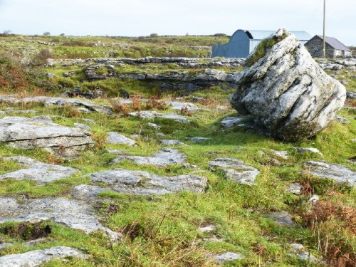
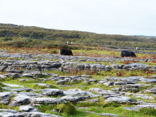
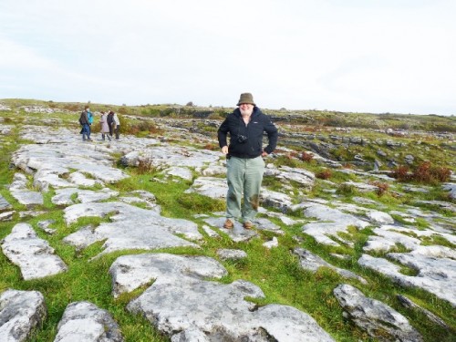
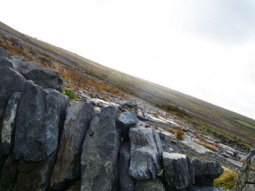
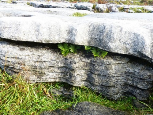
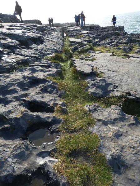
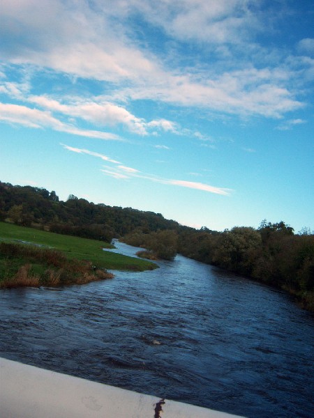
The Burren and the Cliffs of Moher are designated as a Geopark in the County of Clare, reaching Galway Bay and the Atlantic Ocean. We had seen slides of the Burren landscape at a conference in Boston a couple of years prior, were totally intrigued by it and had to see this moon-like, rocky land. We set out one day on a bus tour from Dublin, our home base for a week, into the direction of the Burren, a glacio-karst landscape.* The geology dates back to 350 million years and one can find arctic, Mediterranean and alpine plants, from various periods in the photographs. Contrary to memory, there is much more plant-life in the Burren and we actually saw cows graze in the rocky fields.
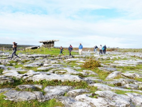
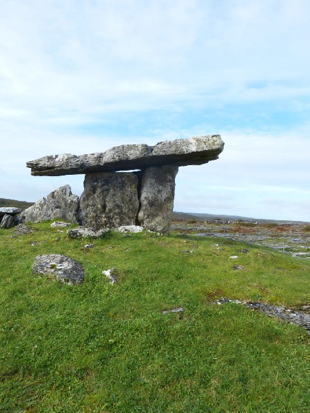
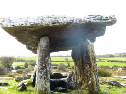
As we approached the Burren (the Gaelic word is Boireanne) and left the last village behind, one could see as far as the eye reached flat rock limestone landscapes with few straggly trees, still quite green. We stopped at Poulnabrone Portal Tomb, photographed and chatted with a park ranger. We learned that this megalithic tomb has been rebuilt, the top stone was replaced, and Poulnabrone is just one of more than 90 megalithic tombs. This one is most famous.
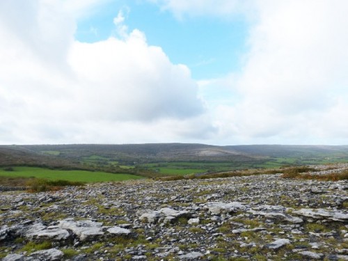
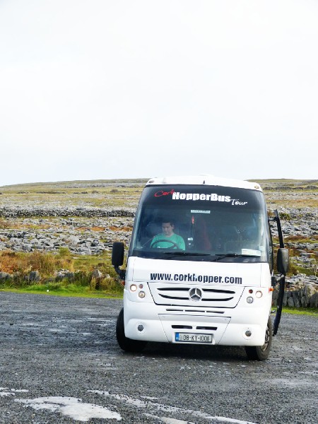
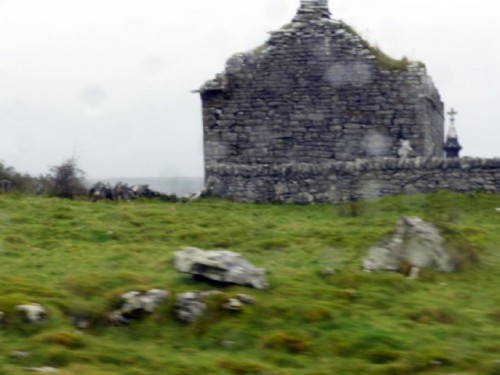
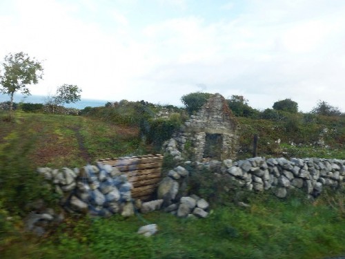
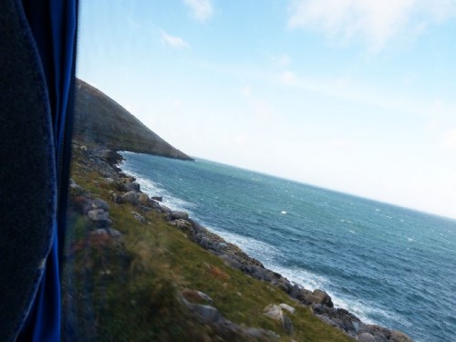
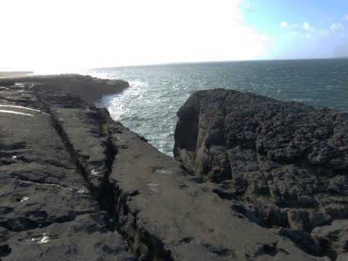
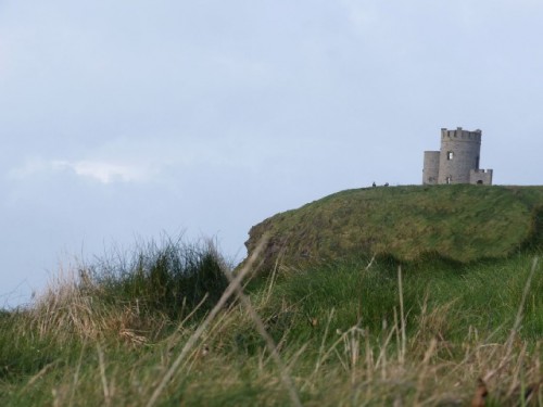
Our bus driver stopped at another parking lot in the Burren region, where one could actually see out to the bay. Then we headed towards the Cliffs of Moher. We had noticed everywhere fences of stones built around houses, using natural resources, of course. We passed withering homesteads, small castles and churches, which were abandoned during the Great Potato Famine in the mid of the 19th Century. As we approached the cliffs, we drove parallel to the Atlantic and soon the coastal road provided magnificent views of the sea.
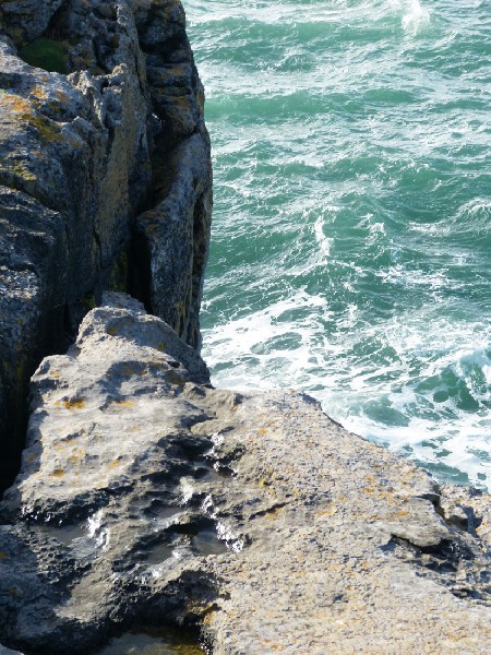
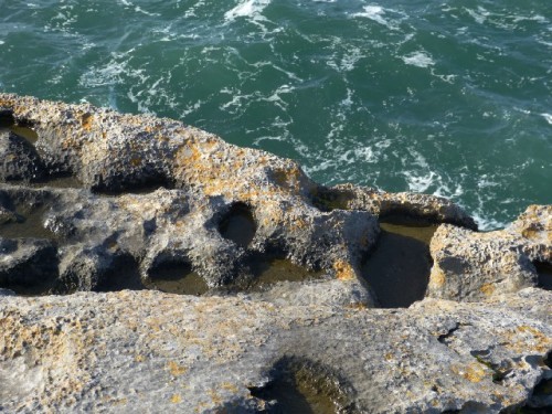
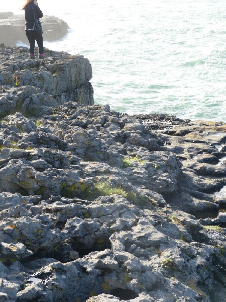
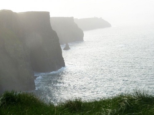
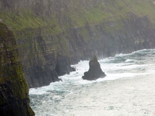
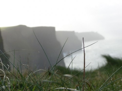
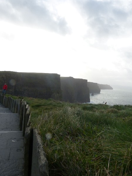
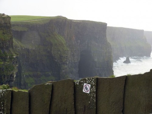
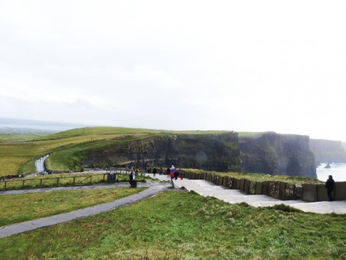
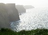
We stopped first at the small Cliffs of Moher, which were according to the driver approximately 75 meters high (210’). There we had a great photo-op, because one could actually step up to the edge of the cliffs, looking down at the Atlantic. It was cool and sunny, half an hour away from the big cliffs. The bus driver urged to move on quickly because weather conditions change rapidly at the cliffs. And it did! We arrived at the Cliffs of Moher amid sun shine. During the two hours there, the weather turned to bursts of rain, then sun, no sun and finally dense fog rolled in and out!
The cliffs are situated at the southwestern edge of the Burren region, still in County Clare. They are fenced in and a long, high stair case leads to the top in the area of the visitors center. The entire cliffs rise from 120 to 200 meters above the Atlantic Ocean (from 360’ to 700’ approximately). The rocks consist mainly of beds of Namurian** shale and sandstone, dating back more than 300 million years. Thousands of birds live on the cliffs made up of many species. We thought to have identified hawks, perhaps eagles and, of course, a large number of big sea gulls. The birds soared high above the sky! A million tourists stop by yearly and on that October day, fellow visitors were abundant. The exhibition at the Visitors Center, which is actually obtusely built into the rocks, was very informative. This series contains a couple of photos of Neolithic stone carvings taken at the exhibition.
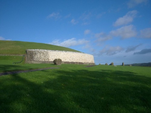
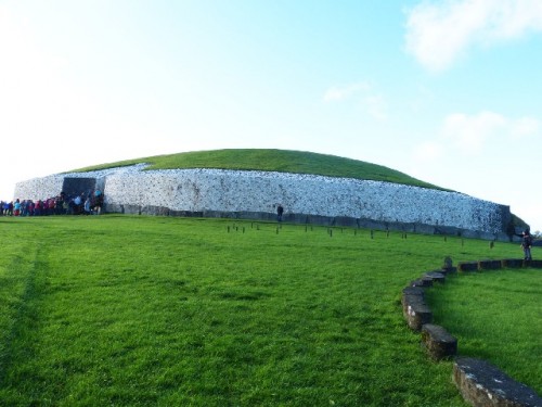
Prior, we went on an afternoon bus trip to Newgrange, a Neolithic monument in County Meath. It is designated as a UNESCO World Heritage Site, built approximately 3200 BC, which dates it 1000 years before the Egyptian pyramids. It is also hundreds of years older than Stonehenge in England.
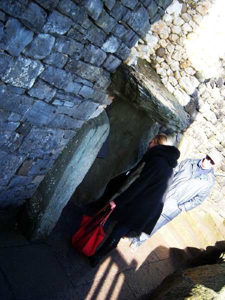
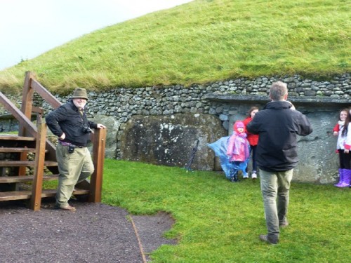
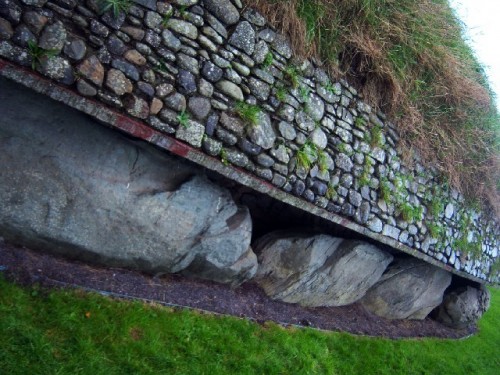
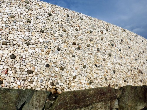
Newgrange reaches approximately 12 meters (36’) above ground, a huge circular stone building, which is covered with soil and grass. The front part has been restored with white quartz stones, visible from afar. The entrance leads along a narrow passageway into three chambers. Groups of approximately 20 people can gather in the largest chamber.
Our guide turned off the lights inside at some point, explaining that during the Winter Solstice, on a few sunny days, sun rays enter from above the door, through the passage and reach the main chamber for a few minutes, illuminating the space. In fact an electrified experience simulated what prehistoric people lived for in this sacred space. It gave us a few minutes of absolute darkness, then, the chamber still taller than 21 Century people lit up – magically!
The Newgrange administration received for the 2013 Winter Solstice 30.000 applications from around the globe. The winners of the lottery to attend a Winter Solstice Tour had already been chosen in October. Of course, the natural phenomenon would only happen on a sunny day. Surely, every December 21st to perhaps 26th, a maximum number of groups are guided inside.
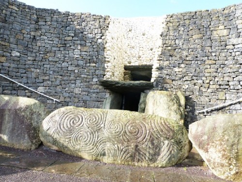
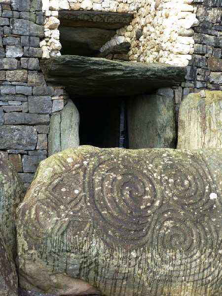
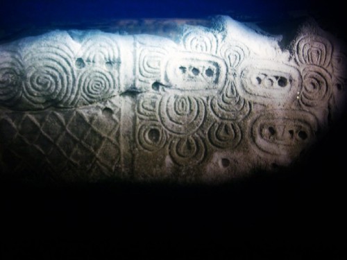
The extensive stone shield in front of the entrance bears Neolithic rock carvings. Just take a look at the intricacies !
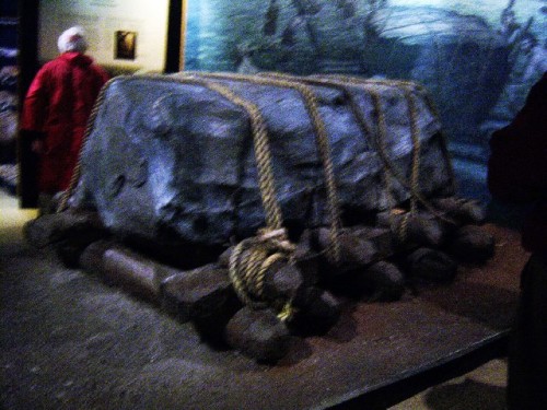
Anthropologists also believe that bones of the dead were placed in the smaller chambers following an outside burial. These huge rocks and blocks of stones were probably moved from as far as 20 km (14 miles) away by land and water along the Boyne River. Amazing accomplishments by prehistoric tribes still unknown today.
Newgrange was sealed by the people who built it, which lasted for millennia. Archeological excavations began in the 17th Century. The frontal reconstruction did not happen until the 1970s. Today, the name inscribed in the World Heritage List is as follows: Archaeological Ensemble of the Bend of the Boyne.
When in Ireland, a trip to Newgrange is a must experience!
* Karst is a landscape formed from the dissolution of soluble rocks including limestone, dolomite and gypsum.
** Namurian: of or relating to a division of the Upper Carboniferous.